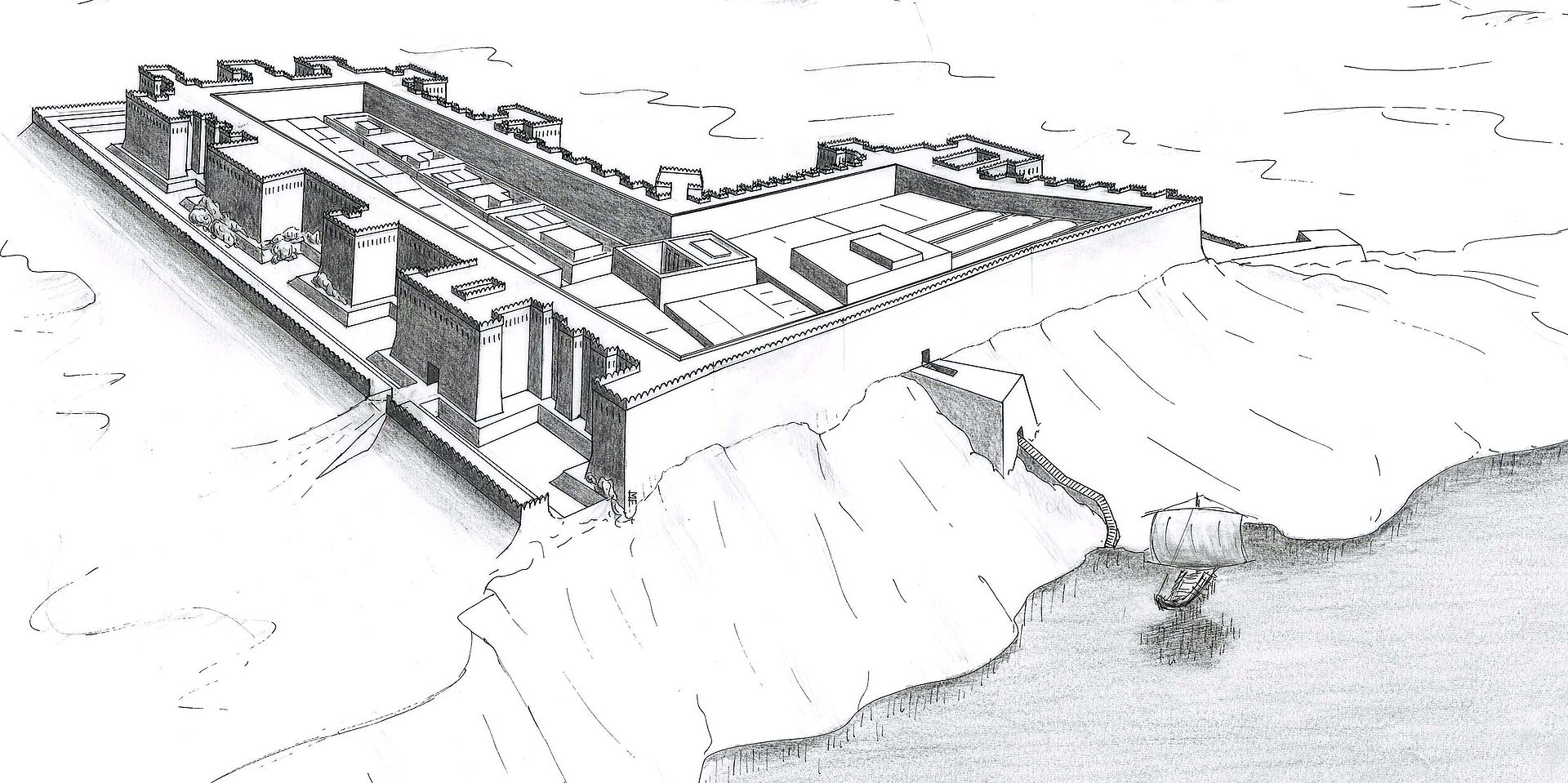
Semna and Kumma Fortresses
Semna-Kumma
Middle Kingdom to New Kingdom (1900–1070 BCE)·Ancient Egyptian occupier·🇸🇩 Northern State, Second Cataract east and west banks, Sudan
About
About Semna and Kumma Fortresses
Paired fortresses of Semna (west bank) and Kumma (east bank) 1 km apart across the Second Cataract — Sesostris III's great customs forts closing Egypt's southern border: Semna West 135×120 m with raised glacis, massive gate bastions and astronomical observation terrace, opposite Kumma 80×70 m with granary and Nile nilometer (oldest flood level marks 14 m above modern low). Semna Stela of Sesostris III decree forbidding negro ship passage north without license. Middle Kingdom road fort line extends to Uronarti and Shalfak. Excavated Reisner 1924 and Dunham before inundation.
Why it mattersSemna stela is earliest border decree and nilometer provides continuous Middle Kingdom flood record correlated with Faiyum hydraulics.
Open questions
Mysteries & theories
Mysteries
- 01Negro ship passage exception for trade vs diplomacy
- 02Glacis military vs flood function
Theories
- 01Semna-Kumma as segmented customs house model for later Roman portorium (Janssen)
Theories are interpretations, not findings. The seal above tells you how much scholarly weight the place carries.
History
How it came to be
- Built
- Senwosret I to Sesostris III c.1900–1860 BCE; nilometer early Middle Kingdom continuous to New Kingdom
- Period
- Middle Kingdom to New Kingdom (1900–1070 BCE)
- Culture
- Ancient Egyptian occupier
- Builders
- Sesostris III
- Purpose
- Twin toll-forts with Nile flood measurement and border decree controlling Nubian boat traffic and gold customs
- Excavation
- Excavated
Senwosret I to Sesostris III c.1900–1860 BCE; nilometer early Middle Kingdom continuous to New Kingdom
Initial construction
c. 1332 CE
Major expansion
On the ground
Structures & features
21.5000° N · 30.9660° E · 210 m · 3 mapped features
Gallery